


.jpg)


Spain, Belgium advance to World Cup quarter-finals
11:26
| Home page History |
|
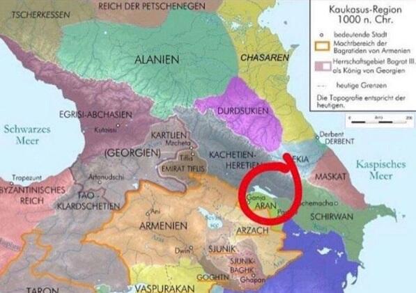
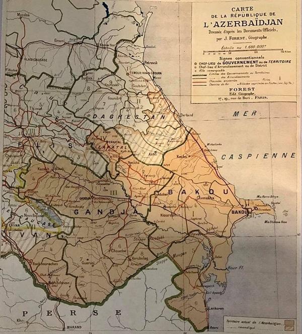
101 years passed away since historical Azerbaijani land Yerevan compromised to Armenia.
On May 29, 1918, the National Council of Azerbaijan made a decision to compromise the Yerevan city as a political center to the Armenians.
Despite Yerevan's compromise, Darelayaz and Zangazur were included in the territory of Azerbaijan. This can be seen from the map of the Azerbaijan Democratic Republic prepared by Josef Forestin, the famous French cartographer.
The map also shows the areas that are controversial with Russia and Georgia.
Axar.az presents you the following map:


|
Date
2019.05.30 / 11:07
|
Author
Axar.az
|